
Monitoring Ground and Structural Movement: Methods, Thresholds and What to Specify
Structures and ground move. Settlement under new load, consolidation of soft soils, creep on a slope, thermal cycling of a bridge deck, and displacement during a seismic event are all normal behaviors, and most of them are slow enough to go unnoticed until they are expensive. The purpose of a monitoring program is not to detect movement — movement is expected — but to know how much, how fast, and whether the rate is changing.
That distinction determines whether a monitoring program is worth its cost. A program that produces numbers nobody has agreed how to interpret produces reassurance, not information. One built around defined thresholds and a defined response produces decisions.
This article sets out the main monitoring methods, what each actually measures, the accuracy ranges to expect, and what a specification needs to contain to be useful.
The value of a baseline
Almost every monitoring question is a comparison, and a comparison needs a first measurement. Without a documented pre-event or pre-construction condition, post-event survey answers “what shape is it now” but not “what changed” — and “what changed” is the question that drives an engineering decision.
This is the strongest argument for capturing a full geometric baseline before intervention begins, before an asset enters a period of risk, and for structures where seismic or hydrological exposure is known. A dense reality modeling capture of a structure and its surroundings is inexpensive relative to the cost of not having it, and it can be re-cut later for questions nobody anticipated at the time.
What the main methods measure
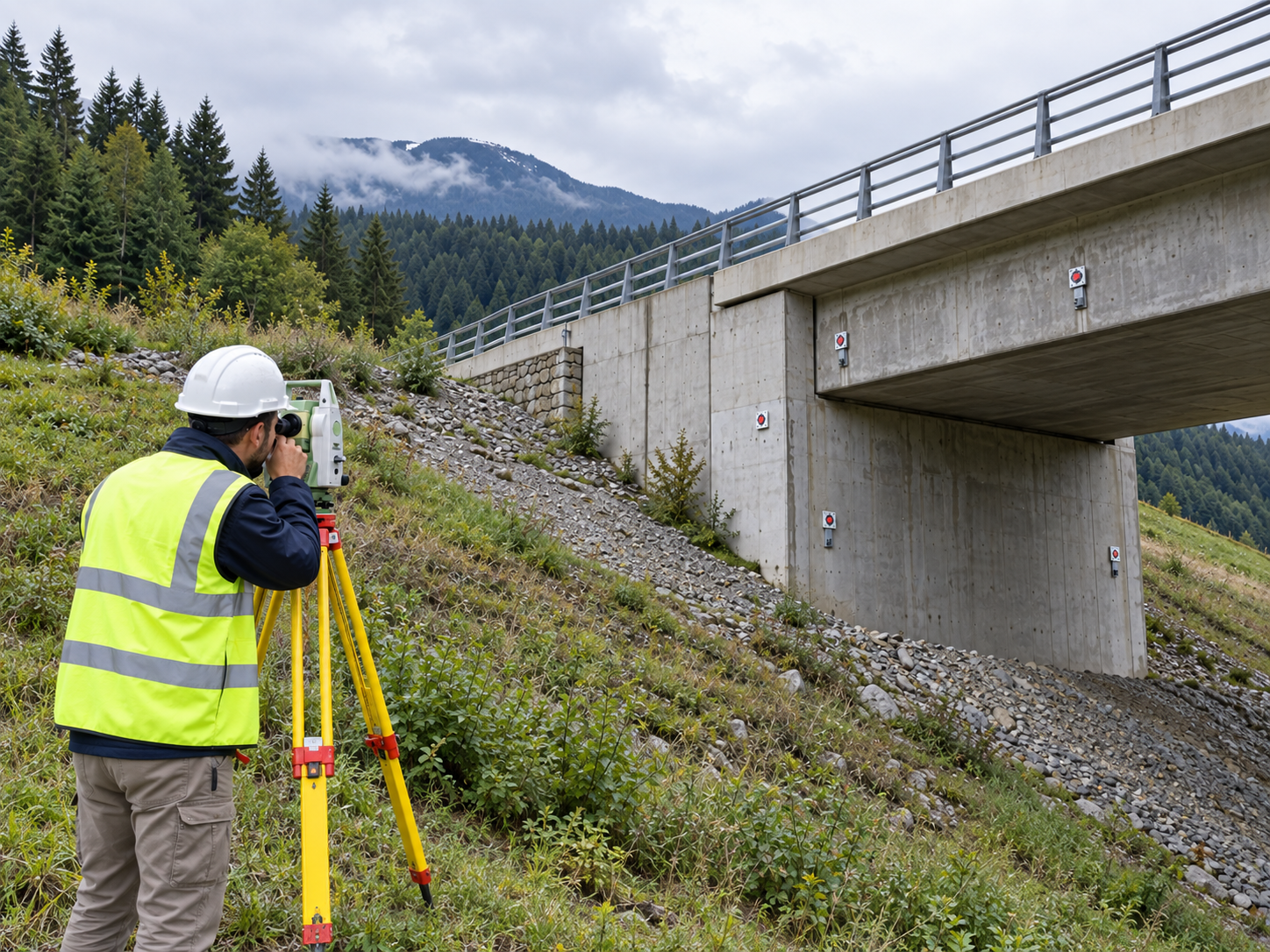
Precise leveling and total station networks. The traditional and still the most defensible approach for discrete points. Optical leveling achieves sub-millimeter vertical repeatability over short networks; automated total stations tracking prisms deliver sub-millimeter to low-millimeter accuracy in three dimensions, continuously. Requires line of sight, stable reference benchmarks outside the zone of influence, and physical access.
Geotechnical instrumentation. Inclinometers for lateral displacement profiles with depth, extensometers for extension across a zone, piezometers for pore water pressure, tiltmeters and crackmeters, strain gauges. These measure the mechanism rather than the surface expression — pore pressure rising before a slope moves is the warning that surface geodesy will report only afterward. Best combined with geodetic monitoring, not substituted for it.
GNSS monitoring. Continuous, works without line of sight between stations, unaffected by weather and darkness. Achieves millimeter-level horizontal and slightly worse vertical precision when processed as long baselines against stable references over hours to days. Suited to dams, large slopes and structures where slow, continuous displacement matters more than instantaneous precision.
Terrestrial laser scanning. Delivers full surface geometry rather than discrete points, with registered network accuracy typically in the range of 3–10 mm across a well-controlled site. Its strength is that it detects movement nobody instrumented — a bulging retaining wall panel, a rotating parapet, spalling that changes a section. Its limit is that it is periodic rather than continuous, and change detection between epochs depends heavily on registering both to the same control.
InSAR. Satellite radar interferometry measures millimeter-scale displacement over wide areas, with archives that often allow retrospective analysis of what a site was doing before anyone was watching. That historical capability is unique and valuable. The constraints are real: it measures along the satellite line of sight rather than in true vertical, needs coherent reflectors (poor over vegetation and water), and delivers results on a revisit cycle rather than on demand. Strong for screening large networks and identifying where to instrument; not a substitute for local instrumentation at a known problem.
UAV photogrammetry and LiDAR. Practical for repeat survey of slopes, stockpiles, landfills and earthworks where centimeter-level change over broad areas is the question. Rapid to deploy after an event, and safe where ground access is not.
Choosing by what you need to know
| Question | Primary method |
|---|---|
| Is this structure settling, and how fast? | Precise leveling, automated total station |
| What is the failure mechanism developing underground? | Geotechnical instrumentation |
| Is this large slope or dam moving continuously? | GNSS, plus instrumentation |
| Has the geometry of this structure changed since baseline? | Terrestrial laser scanning against baseline |
| Which assets across my network are moving at all? | InSAR screening |
| What changed across this terrain after an event? | UAV repeat survey |
Thresholds are the specification
A monitoring program without agreed thresholds is data collection. A usable specification states, before the first reading:
- What is measured, where, and to what accuracy — with the accuracy demonstrated against control, not quoted from a brochure.
- Baseline and reference stability — where the references are, why they are outside the zone of influence, and how their stability is verified.
- Trigger levels — typically a green/amber/red structure: a value that is normal, one that requires investigation and increased frequency, one that requires intervention. Set against the engineering assessment, not against instrument precision.
- Rate as well as magnitude. Total displacement matters, but acceleration is usually the earlier and more reliable warning.
- Who acts, and within what time. A trigger with no named owner and no response time is not a trigger.
- Reading frequency, and what changes it. Frequency should increase automatically when amber is reached.
Two practical points recur. First, apparent movement is often reference movement — a benchmark inside the settlement zone will make a stable structure look like it is failing, and this is one of the most common false alarms. Second, thermal and seasonal cycles produce displacement signatures that can exceed the trend being monitored; a dataset shorter than a full annual cycle can easily be misread.
Why Choose ARGO-E
ARGO-E combines geotechnical engineering with survey-grade geospatial capability, which matters because a monitoring program designed by surveyors alone tends to measure what is easy to measure, and one designed without survey input tends to specify accuracies that cannot be delivered. Our teams set the instrumentation and geodetic scheme against the engineering mechanism and the threshold framework, deliver the baseline, and interpret the readings against it.
Our Capabilities
- Geotechnical Engineering Services — instrumentation design, threshold setting and interpretation of ground and structural behavior.
- Geospatial Data Services & Remote Sensing — geodetic control, precise survey, GNSS, UAV and satellite-based monitoring.
- Reality Modeling — geometric baselines and epoch-to-epoch change detection on structures and terrain.
- Data Science & Analytics — trend analysis, rate detection and separation of seasonal signal from real movement.
Contact ARGO-E to design a monitoring program built around defined thresholds and a documented baseline, rather than around the instruments that happen to be available.